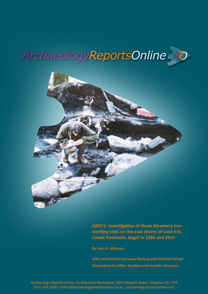
Investigations of three bloomery mounds by Lock Eck in Argyll revealed an important but largely concealed medieval industry. This archaeological research, undertaken by GUARD Archaeologists, has recently been published in the latest ARO.
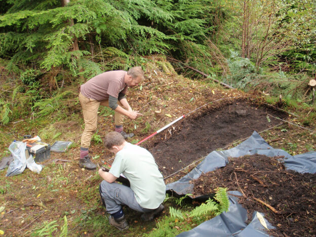
In 2015 three bloomery mounds by Loch Eck, Argyll were revisited for further scientific and environmental analyses, as well as for radiocarbon dating. One of these sites had previously been investigated in 1995 and 1996, as part of the Scottish Bloomeries Project.
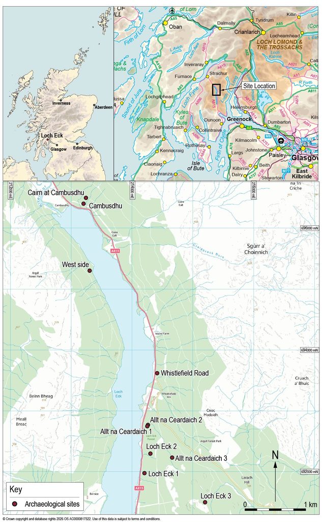
Site Locations
Prior to 1995, little concentrated effort had been put into understanding the archaeology of bloomery iron production sites in Scotland. The interest which had been pursued came from antiquarians, local historians or local archaeology groups. Many of the basic questions in relation to bloomery sites in Scotland remained unanswered, particularly key questions on absolute dating of these sites, the sources of ore being used and how they related to the social milieu of the period in question. Since the late 1990s, a number of investigations have cast further light on the location and form of the bloomery tradition elsewhere in the Scottish Highlands.
The results of this project demonstrate that smelting took place on Loch Eck for at least 300 years from the thirteenth to seventeenth century AD. The main fuel was birch charcoal supplemented with the use of other local woodland resources.
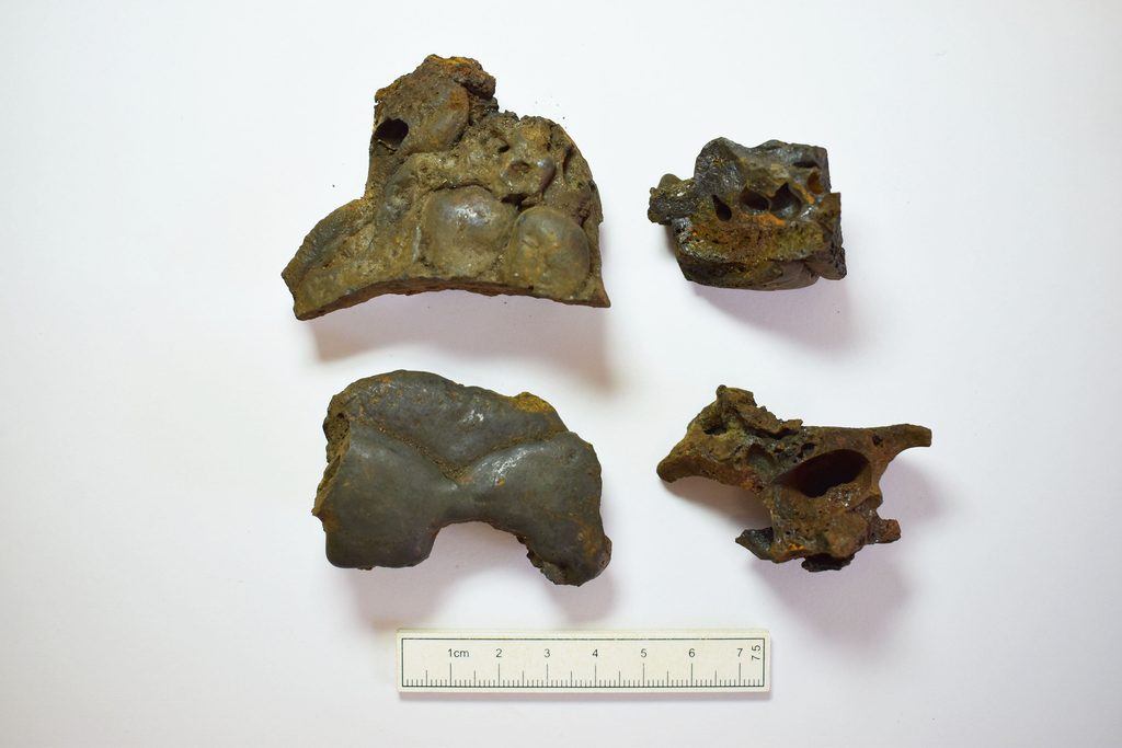
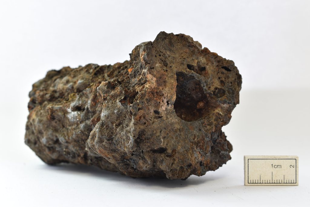
The type of metalworking waste recovered during the fieldwork indicates that both smelting and primary smithing of the iron bloom were carried out at all three of the locations investigated. The slag mounds at all three locations were large, most especially that at Allt na Ceardaich 1 and, for such volumes of waste to accumulate, smelting must have been carried out over relatively long periods of time.
These mounds are evidence of an important but largely concealed Medieval industry that has much to reveal about the scale and nature of the iron smelting industry in Argyll and across Scotland.
The archaeological work was funded by Forestry and Land Scotland, with radiocarbon dating supported by Historic Environment Scotland. Now that the work has been completed, the project archive will be submitted to the National Record of the Historic Environment. The artefacts will be submitted through the Scottish Treasure Trove system whereby they will be allocated to an appropriate museum.
The excavation report, ARO71: Investigation of three bloomery iron working sites on the east shores of Loch Eck, Cowal Peninsula, Argyll in 1996 and 2015 by John A. Atkinson is freely available to download from Archaeology Reports Online.
New house owners at Erskine in Renfrewshire may not be aware that they inhabit the same space where a hitherto lost prehistoric settlement once was. Mysteriously abandoned over three thousand years ago, the archaeological remains, long buried and forgotten, have been brought to light in a new publication.
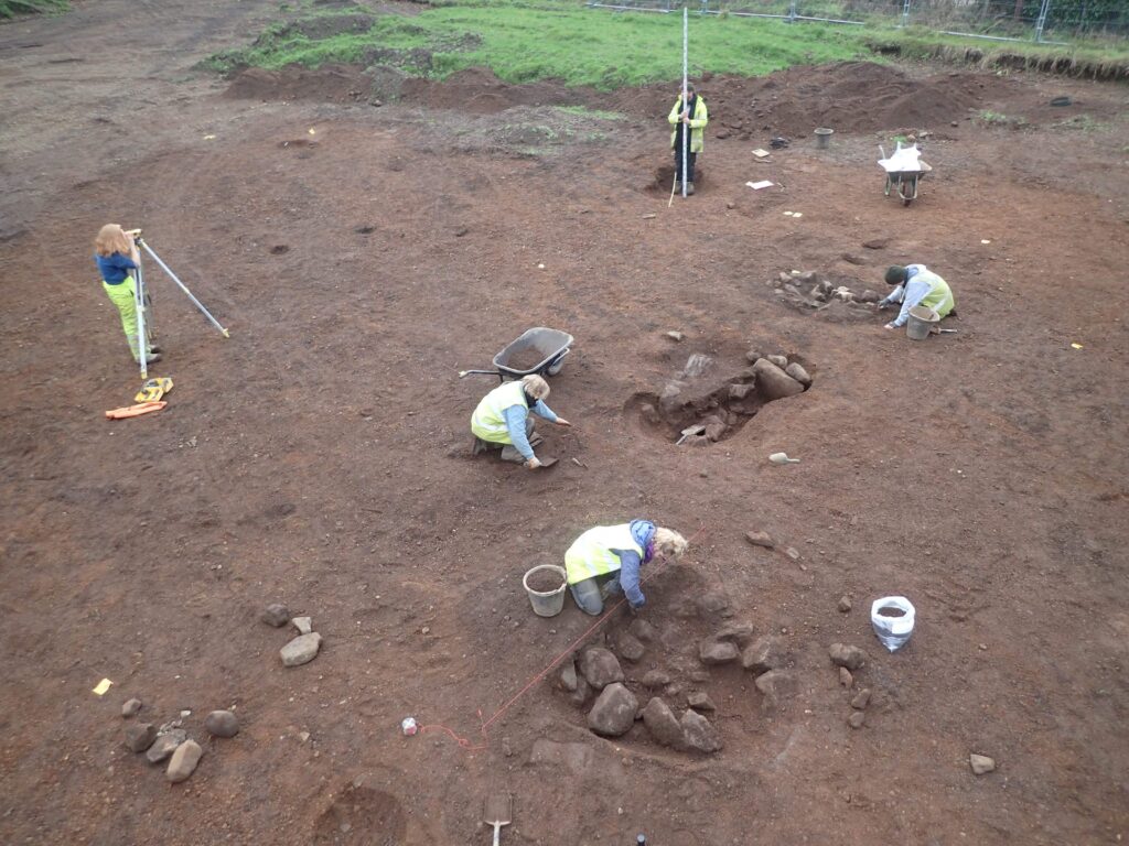
The discovery was made by GUARD Archaeology during archaeological excavations between 2018 and 2019, commissioned by CALA Homes (West) prior to construction of new houses at Northbar on the south-east outskirts of Erskine.
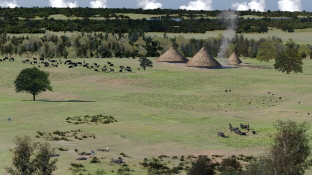
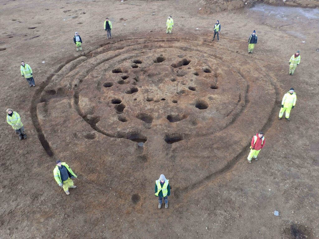
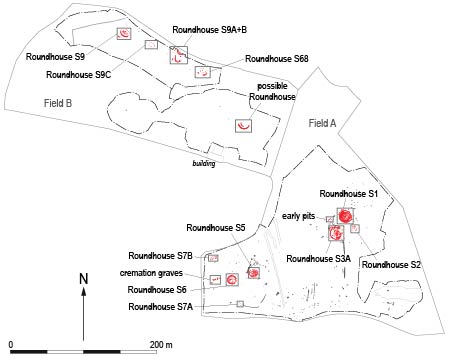
The archaeological evidence gathered at Northbar demonstrates that the site was occupied between 1500 and 1100 BC. Our team encountered the remains of 12 roundhouses strung out across the site, a settlement that had developed over several centuries. While only post-holes and trenches survived where roof-bearing posts and wattle-and-daub walls once stood, the scale of these demonstrate that some of these roundhouses were extremely large timber structures, likely the homes of large households of people.
The evidence gathered during GUARD Archaeology’s excavation has provided a rare insight into daily life during this middle Bronze Age period, from evidence of crop production and processing, animal husbandry, weaving, pottery-making, to the construction techniques for the large timber roundhouses these communities built.
Within the roundhouses burnt animal bones and charred barley and wheat grains attest to the farming of the surrounding open wooded landscape. Traces of animal dung were also found within two of the roundhouses, reflecting seasonal cohabitation of both humans and animals living together under the one roof. But a substantial quantity of hazelnut shells within one of these roundhouses also attests to the autumnal gathering and storage of wild food resources, possibly to sustain the household over the coming winter in the event of a bad grain harvest. GUARD Archaeologists have found evidence for famine and catastrophes amongst other Bronze Age communities in south-west Scotland, so winter starvation was no idle threat at this time.
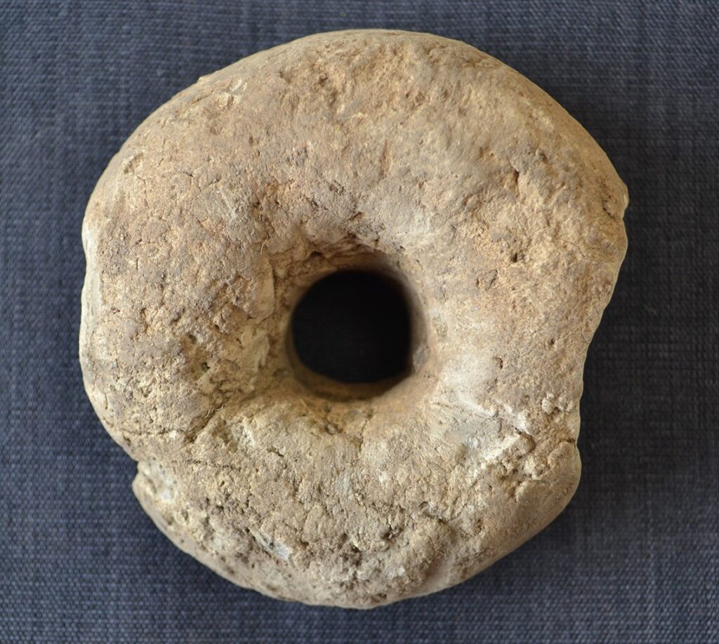
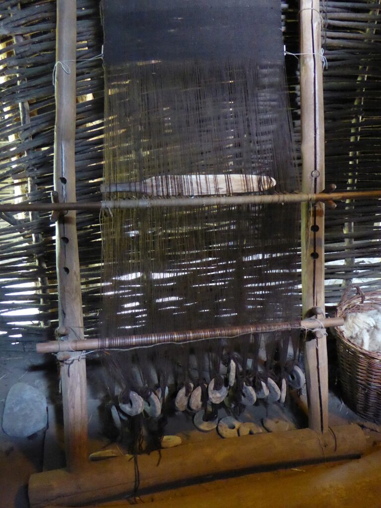
But the occupants were not just farmers. Several kiln pits, rare evidence from this period, were found within one of the roundhouses, demonstrating the manufacturing of pottery vessels within the Bronze Age settlement. Numerous clay loom weights attest to the weaving of woollen cloth too. This evidence demonstrates that the Bronze Age folk here crafted pottery vessels for the cooking and storage of food, and processed woollen yarn into clothes. While communities were well-connected with each other during this time, this evidence shows that they were also self-sufficient for the basic necessities of life.
This was not the earliest activity at Northbar however. The GUARD Archaeologists discovered that a few centuries before the first roundhouses were built here, a small cemetery had been created in one corner of the site during the early Bronze Age. These graves contained the cremated bones of at least 9 people together with sherds of ceramic Beakers and Urns, that were buried alongside the dead to accompany them in the afterlife. It may even be that it was these graves and the reputation of the people buried here that first attracted a small Bronze Age community to settle on this site.
The Bronze Age settlement at Northbar seems to have drawn to a close around 1100 BC, but why this happened remains a mystery. There was no evidence of burning or destruction, and many similar settlements from this period such as discovered at Rosemarkie on the Black Isle and at Carnoustie in Angus similarly ended around the end of the Bronze Age. Communities moved on to other places in the landscape, and other than some ephemeral remains of Iron Age activity over one thousand years later and a fragment of a burnt cereal grain from the fifteenth century, there was no other trace of people on this site until the construction of CALA Homes’ new houses.
The archaeological work was funded by CALA Homes (West) and was required as a condition of planning consent by Renfrewshire Council who are advised on archaeological matters by the West of Scotland Archaeology Service. Now that the work has been completed, the project archive will be submitted to the National Record of the Historic Environment held by Historic Environment Scotland. The artefacts will be submitted through the Scottish Treasure Trove system whereby they will be allocated to an appropriate museum.
The excavation report, ARO70: Bronze Age Graves and Roundhouses at Northbar, Erskine by John-James Atkinson, Beverley Ballin Smith and Dave McNicol is freely available to download from Archaeology Reports Online.
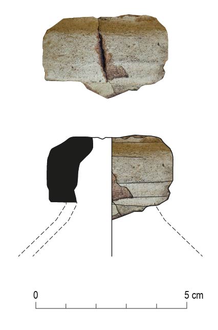
A fragment of Spanish olive jar found during our excavations in advance of Edinburgh’s Trams extension reveals that this mediterranean luxury item was imported into Leith during the sixteenth-seventeenth centuries.
But not for cooking!
Rather it was used by apothecaries for medicinal treatments and for soap-making.
Sherd of Spanish olive jar recovered from GUARD Archaeology’s excavation in Leith
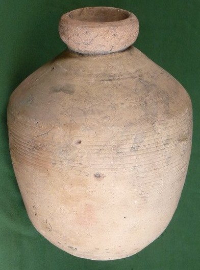
Spanish vessels and olive jars in particular have been recovered from other sites in Leith and Edinburgh and generally date to the sixteenth or seventeenth century. Olive jars are quite distinctive in shape and colour – they have a red/pink sandy fabric with an off-white to buff coloured slip on the exterior. A near complete vessel was found in 1984 at Newark Castle in Port Glasgow.
Trading during this period was heavily influenced by politics (as it is nowadays) and attempts were made by the Scottish Kirk to prohibit trading with Habsburg Spain and its dominions at the end of the sixteenth century. However, trade was restored a few years later and a regular trade was in place by the second half of the seventeenth century with Glasgow as the main port.
This trade carried on well into the following centuries, as evidenced by the collection of nineteenth century olive jars in Edinburgh Museum.
A seventeenth-century ‘botija perulera’ from Seville. The egg-shaped botija was the most common form of olive jar. Milartino, CC BY-SA 3.0 <https://creativecommons.org/licenses/by-sa/3.0>, via Wikimedia Commons
Other imported ceramics, evidencing trade with other parts of mainland Europe, include Rhenish stonewares (from the Rhineland of Germany) and cooking vessels from the Low Countries (Netherlands). Large ports like Rotterdam were used by Scottish merchants to buy these wares, and probably buying goods from Spain too when regular trade was prohibited.
Newly published research by GUARD Archaeology has revealed how a hitherto unknown Antonine Wall Roman fortlet was discovered beneath the back gardens of Bearsden.
Archaeological investigations within the gardens of three adjacent residential properties in Bearsden in 2017 revealed the stone foundations of a turf rampart. The archaeological work was funded by individual landowners in advance of development and was required as conditions of planning consents by East Dunbartonshire Council.
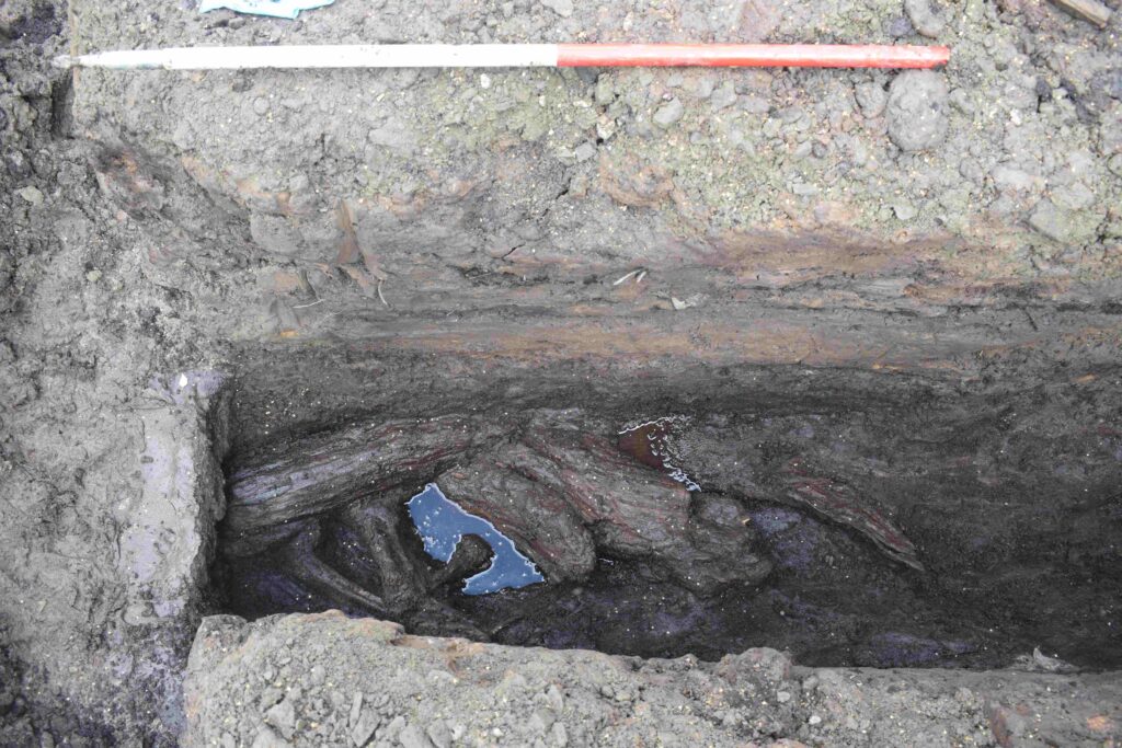
Historic Environment Scotland identified the investigations as a rare but important opportunity to discover more information about this particular area to the south of the World Heritage Site of the Antonine wall. Historic Environment Scotland subsequently commissioned further excavation which revealed a parallel ditch containing peat deposits, wood and vegetation, and also a geophysical survey which revealed stone structures, likely surviving fragments of the Antonine Wall itself.
What made these discoveries significant was that both the kerbed stone base and its parallel ditch lay perpendicular to the line of the Antonine Wall that crosses this part of Bearsden.
Wood from the bottom of the ditch was radiocarbon dated to AD 127–247 and therefore within the period of use and immediate aftermath of the Antonine Wall. Two sherds of Roman pottery were also subsequently found beneath the stone base.
The Antonine Wall was built in the years following AD 142 by the Roman Army on the orders of their emperor Antoninus Pius (hence its name). Cutting Scotland in two, it separated the conquered Britons of the south from the free Britons to the north. Unlike Hadrian’s Wall, which was built of stone, the Antonine Wall was constructed of turf set onto a stone base. But little more than 20 years after it was built, sometime in the AD 160s, the Romans retreated back to Hadrian’s Wall.
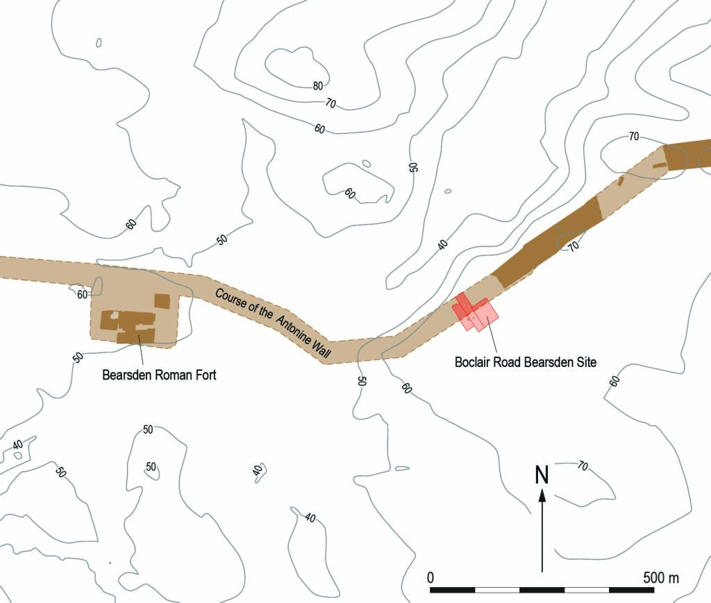
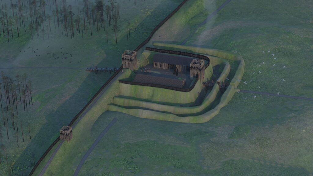
This fortlet lay on an area of high ground right next to the Antonine Wall. It had commanding views over the landscape, particularly to the north, which was beyond Roman control, and was also intervisible with the larger Roman fort at Bearsden which lay close-by to the west on lower lying ground. This suggests that the fortlet was an integral part of the Roman Wall defences which included forts along its length along with smaller fortlets like this, where small detachments from the larger forts were posted to keep an eye out.
Specialist analysis of the botanical and fossil beetle evidence from the bottom of the ditch revealed that when the fort was built, the surrounding landscape was open pasture with areas of partially cleared woodland, mainly alder, hazel and willow, with lesser amounts of oak and birch. Grasses were present within the cleared areas.
The work within the three gardens in Bearsden has revealed how important the planning process is to archaeological investigation and the discovery of new sites. Given their location and date, the archaeological remains discovered in the back gardens of Boclair Road are related to the Antonine Wall and it would therefore seem that the stone base supported a turf wall and the ditch was a section of the perimeter ditch around a hitherto unknown Roman fortlet.
ARO65: Discovery of an Antonine Wall Roman Fortlet at Boclair Road, Bearsden by Maureen Kilpatrick, with contributions by Michael Bamforth, Nysa Noelle Loudon, Coralie Mills, Susan Ramsay, Katharine Warden and Nicki Whitehouse is freely available to download from Archaeology Reports Online.
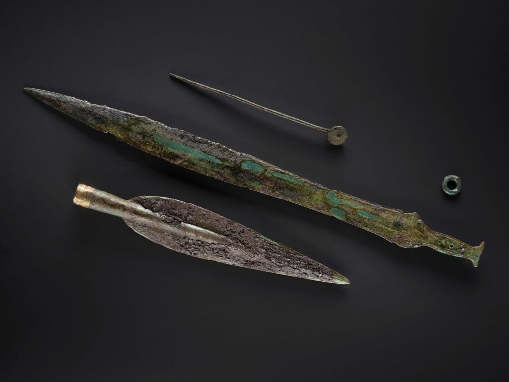
GUARD Archaeology’s work in bringing two Scottish Bronze Age Hoards to light has been nominated for Current Archaeology’s Research Project of the Year Award 2026.
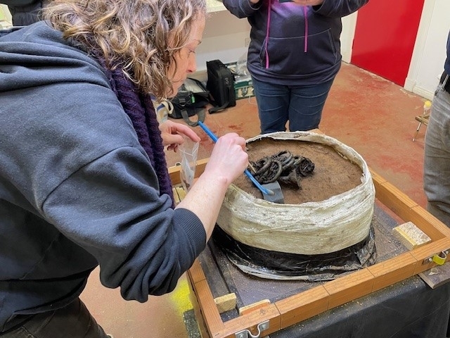
GUARD Archaeology led the post-excavation analyses of the Carnoustie and Rosemarkie hoards undertaken by experts drawn from across Britain including National Museums Scotland, the universities of Glasgow, Stirling, Bradford and Exeter, various independent specialists and GUARD Archaeology itself.
Through careful minute analysis of every strand of evidence, the organic remains as well as the metals, an enormous amount was revealed about the people who buried these hoards at the end of the Bronze Age.
The post-excavation analyses of finds recovered from Carnoustie and Rosemarkie revealed exceptional archaeology.
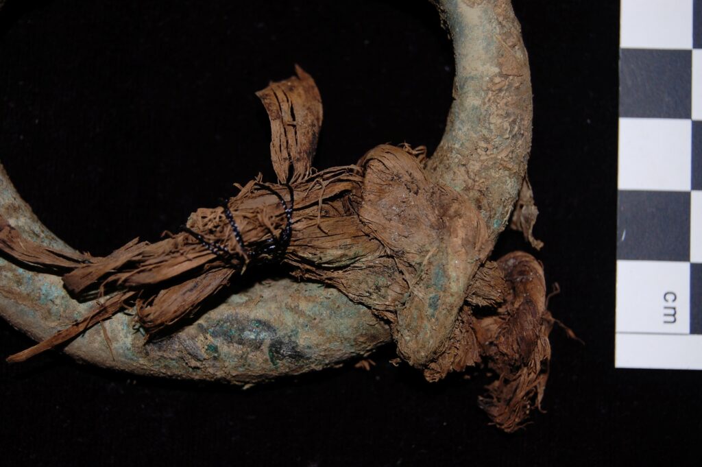
The organic remains such as the Carnoustie sword scabbard enabled radiocarbon dating of the Carnoustie hoard to 1118-924 BC, earlier than when traditional typologies would place it. While tree bast used to tie many of the Rosemarkie bangles together provided a secure radiocarbon date for the burial of the Rosemarkie hoard: 894-794 BC, at the very end of the Bronze Age.
The metallurgical analyses of both hoards revealed the extensive exchange networks with southern Britain, Ireland and the continent, from which Late Bronze Age metalworkers in Scotland ultimately sourced the materials they shaped into precious objects.
Intriguingly both hoards were buried close to contemporary Bronze Age settlements, leading the GUARD Archaeologists to examine the reasons why these hoards were buried in the first place. Unlike founders’ hoards or metalworkers’ stashes of damaged objects and fragments that could be recycled, or votive hoards of deliberately broken objects thrown into watery places with no chance (or apparent desire) of recovery, the Rosemarkie and Carnoustie hoards contained treasured items that were collected together, wrapped, and neatly buried for safekeeping close to a settlement where they could be guarded and easily retrieved when the time came.
The question, then, is not so much why they were buried, but why the time never came for these Bronze Age communities to retrieve their valuable belongings.
The excavation reports – ARO60: Neolithic timber halls and a Bronze Age settlement with hoard at Carnoustie, Angus by Beverley Ballin Smith, Alan Hunter Blair and Warren Bailie; and ARO62: ‘A Hoard, Spear Moulds and a Bear, Oh my!’ a Late Bronze Age Settlement at Greenside farm, Rosemarkie by Iraia Arabaolaza, Rachel Buckley, Sam Williamson and Alun Woodward – are both freely available to download from Archaeology Reports Online.
Newly published research by GUARD Archaeology has revealed a mysterious mass burial event in the Nithsdale hills some 3,300 years ago.
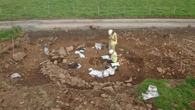
The archaeological excavations were undertaken in 2020 and 2021 by GUARD Archaeology during the construction of the access route to Twentyshilling Wind Farm across an area of open rough upland terrain to the south of Sanquhar in Dumfries and Galloway.
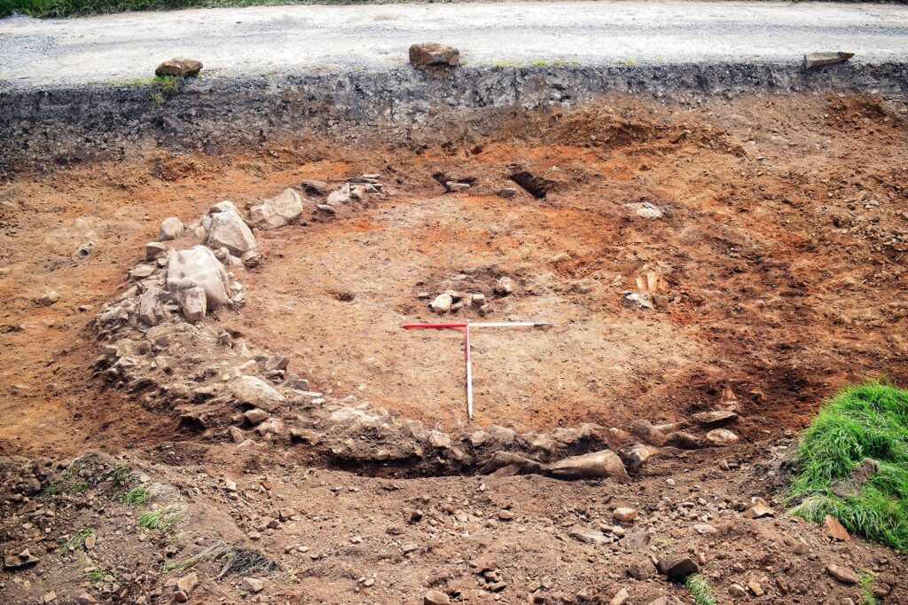
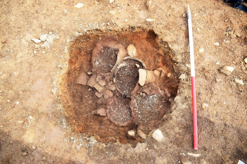
The fieldwork revealed a Bronze Age barrow. Post-excavation analyses revealed that the five closely packed urns found in a pit within the centre of the barrow contained the cremated bones of at least 8 individuals. They were placed there during one mass burial event sometime between 1439 – 1287 BC.
A small group of pits some distance north was also excavated, revealing late Neolithic activity between 2867 – 2504 BC.
The discovery of a Bronze Age Barrow and an earlier Neolithic pit group was a relative surprise as there was very little evidence of prehistoric activity in the immediate area prior to the Twentyshilling Hill fieldwork. This new archaeological evidence provides a unique glimpse into the prehistoric landscape south of Sanquhar, a landscape lightly peppered with unexplored and undated cairns and earthworks but until now, very little tying any specific part of the landscape to any particular period of time.
The work at Twentyshilling has shown that the area was sparsely inhabited by Neolithic people with a certain amount of ancestral knowledge bringing people back to the same spot for reasons long lost to us today. The barrow suggests a more settled occupation of the area during the Bronze Age with ties to the landscape as well as shared cultural links with much of Scotland demonstrated in their customs of burying their dead, such as the combination of an adult and a juvenile within each urn.
The five urns in the Twentyshilling Barrow contained at least eight individuals. The urns were deposited at the same time as they were packed tightly within the pit and adhered to the same fifteenth to thirteenth century BC date range. This indicates that this was a single mass burial, possibly of the same family or group.
The bodies of the deceased at Twentyshilling had not been left out for a lengthy period of time to partially decay, as is common in other barrows. This also indicates that they were interred at once, rather than over a longer period of time. At Broughton in the Scottish Borders, another barrow GUARD Archaeologists have excavated in recent years, the bodies of the deceased had all been exposed for a long time prior to cremation indicating an extended period of time between death and interment. And at Broughton as in many other Bronze Age barrows in Scotland, the burials were inserted over a protracted period, not all at once.
This was not apparent at Twentyshilling, perhaps because the local community here had less time to perform the burial rituals. The Bronze Age in Dumfries and Galloway may have been a time of particular stress as other burials, such as at Blairbuy in the Machars show evidence of famine and abandonment.
The archaeological work was funded by R J McLeod and Statkraft in advance of the Twentyshilling Wind Farm. It was required as a condition of planning consent by Dumfries and Galloway Council who are advised on archaeological matters by the Dumfries and Galloway Council Archaeology Service.
ARO64: Twentyshilling Hill Bronze Age Barrow, Dumfries and Galloway by Thomas Muir, with contributions by Torben Ballin, Beverley Ballin Smith, Susan Ramsay and Alun Woodward is freely available to download from Archaeology Reports Online.
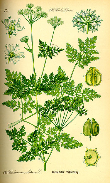
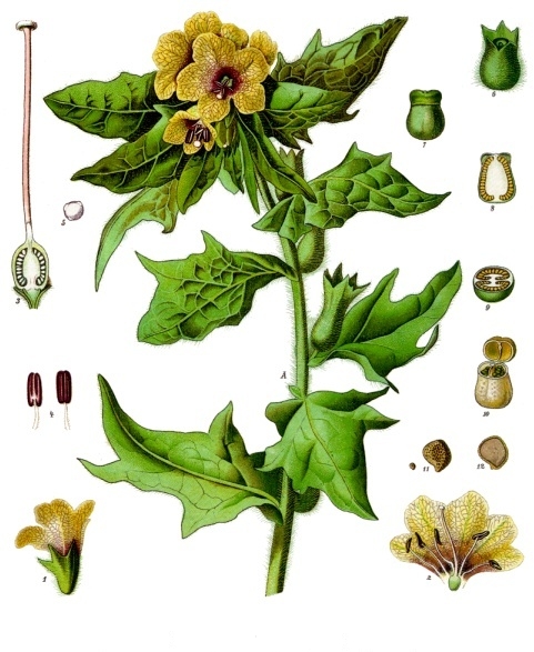
Some interesting botanical remains were recovered from our excavations undertaken in advance of the Edinburgh Trams extension to Newhaven. Seeds of henbane and one seed of hemlock were found during the works in few midden deposits along with uncarbonised seeds of food plants including fig, wild strawberry and grape seeds.
Henbane and hemlock seeds are highly toxic members of the nightshade family but have important medicinal constituents. They are both now rare in Scottish flora which might suggest that henbane was either more common in antiquity, or was intentionally cultivated. Hemlock on the other hand might have growth locally as it does grow more commonly towards the east, and particularly near the sea.
Henbane
Henbane has important medicinal constituents, found especially in the leaves, but also to a lesser extent in the seeds and other parts of the plant. The active ingredients are hyoscyamine, atropine and hyoscine, which have narcotic, analgesic and sedative properties. The seeds are notorious for their longevity and have been known to sprout from freshly excavated soil heaps from archaeological excavations, especially those of castles or monastic enclosures. They have been found in medieval Perth, as well as on many other sites, all Roman or post-Roman. Henbane was known as ‘the witch’s plant’ and it was commonly used for its painkilling and sedative effects, although higher doses could be deadly!
Hemlock
All parts of the hemlock plant are poisonous, including the seeds, although there are some claims that plants that grow in cold climates are less poisonous than those growing in warmer areas. The active ingredient in hemlock is coniine which has painkilling and sedative properties but is a very potent poison if administered incorrectly. Hemlock seeds were found associated with henbane in a cesspit deposit from the Roman fort of Elginhaugh in Midlothian. It was also recorded from deposits thought to have come from an early herb garden (c. 500-730 AD) at Whithorn. At Whithorn the hemlock seeds were associated with large numbers of seeds of small nettle, another species common at the Edinburgh Trams excavation sites. The medieval and post-medieval drain fills from Paisley Abbey also yielded seeds of hemlock as did midden deposits from Edinburgh and Stirling.
Is there anything scarier than tiny creepy worm-like creatures growing inside your body unbeknownst to you? For this Hallowe’en we will be discussing parasites…
Parasite infection was common in the population of medieval Leith as was the case in other European medieval cities, as the largest archaeological study so far of its kind on medieval populations in Scotland reveals.
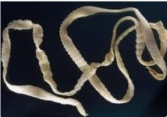
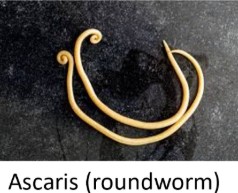
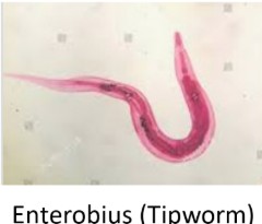
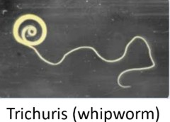
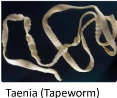
Remains of parasite eggs were found within soil samples taken from around the belly area of skeletal remains during GUARD Archaeology’s excavation of graves beneath Constitution Street in this part of Edinburgh. This was once part of the medieval graveyard of South Leith Parish Church. Nearly half of the 185 analysed skeletons were affected by at least one of four different types of parasites – Ascaris, Trichuris, Enterobius and Taenia.
While these names may not be familiar, some of them have been living with (or in!) us for a long time. Traces of Trichuris (whipworm) were reported from Ötzi, the frozen mummy of a man found in the Alps and who had lived during the Copper Age sometime between 3350 and 3105 BC.
The presence of Taenia parasite eggs indicate that the medieval Leith population, including adults and children, were eating undercooked/raw pork or beef. The presence of Taenia (tapeworm) in children was unusual and indicates not only that they were eating the same food as the adults but also that the animal feed was contaminated by this parasite too. It is possible that human faecal material was used as fertiliser for food later fed to livestock.
The rest of the parasites, Ascaris (roundworm), Trichuris (whipworm) and Enterobius (tipworm) are all soil transmitting helminth (worms), which essentially means that infection was via a direct faecal-oral route. Lovely.
This evidence demonstrates the poor sanitation and hygiene of the time.
And the importance of cleaning your hands after going to the loo!!
GUARD Archaeologists’ excavation of a hilltop settlement near Perth revealed a lost settlement that thrived during the Iron Age only to mysteriously fade away before the coming of the Romans, new publications reveal.
The excavation was undertaken by GUARD Archaeology in 2022 as part of the £118m Cross Tay Link Road project that involved the construction of a new 3-span bridge over the River Tay and six kilometres of new road by BAM Nuttall Ltd. Since the excavation was completed, GUARD Archaeologists have led a team of specialists drawn from across Scotland including National Museums Scotland, the universities of Glasgow and Stirling, various independent specialists and GUARD Archaeology itself, to analyse the archaeological evidence and reveal new insights into Iron Age Scotland.
‘Perth and Kinross Council are delighted that these archaeological discoveries, as a result of our construction of the Cross Tay Link Road, have led to a significant advancement in the understanding of an Iron Age community that once lived here,’ said Jillian Ferguson, Roads Infrastructure Manager at Perth and Kinross Council. ‘Many drivers and passengers travelling the new road may not imagine that they cross the site of a prehistoric fort. The construction of the Cross Tay Link Road at this site has provided an inadvertent but invaluable opportunity to learn more about how people near Perth lived more than two thousand years ago.’
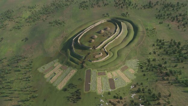
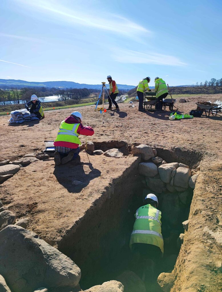
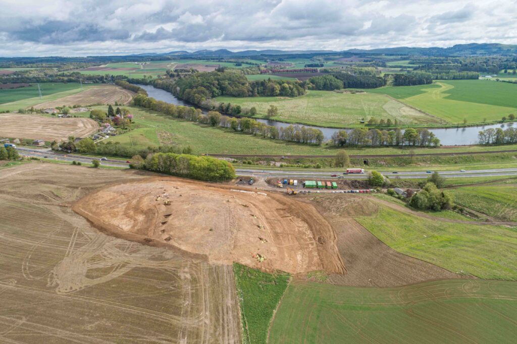
‘The hillfort at Broxy Kennels was first identified in the 1960s on aerial photographs taken along the proposed route of the then-new A9 road,’ said GUARD Project Officer Kenny Green, who directed the excavation. ‘Without these aerial photographs no-one would have known there was a hillfort here as there was no trace of it on the ground. Centuries of ploughing had removed any surface trace.’
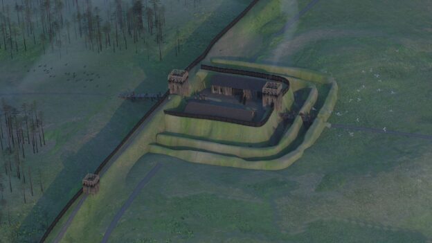
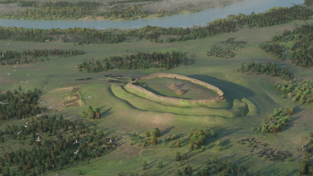
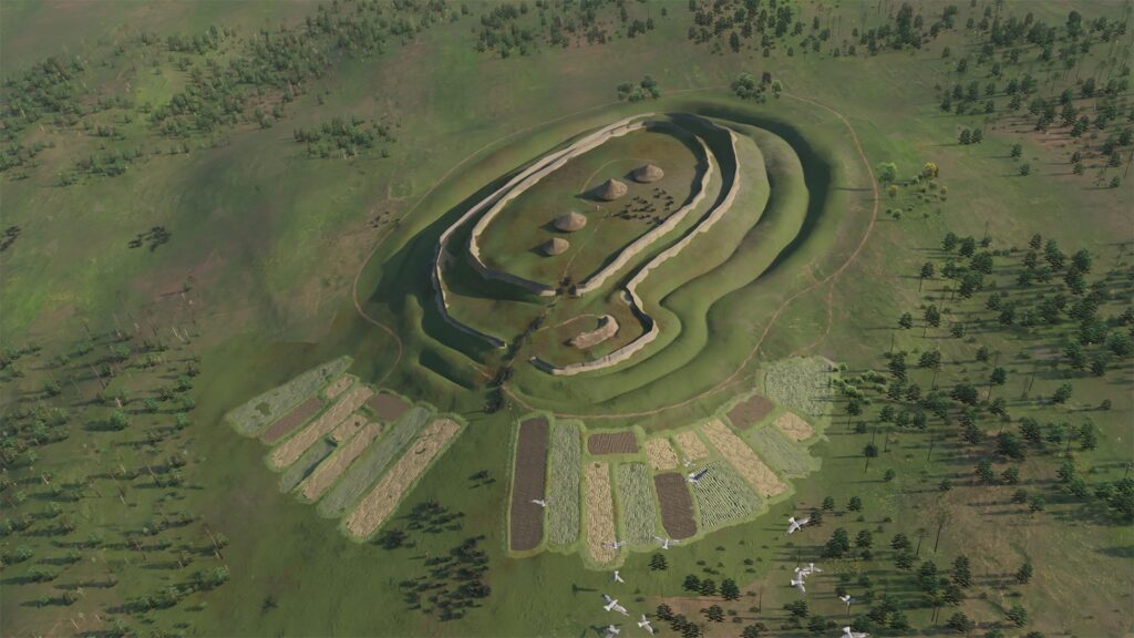
The excavation team discovered that it was during the Iron Age when people decided to settle permanently on the hill here. Many Iron Age hillforts can be found across Britain, with almost 1500 in Scotland alone. But these were not all occupied at the same time and these were not military forts. Instead, these were fortified hilltop settlements. The location of Broxy Kennels may have been chosen as a prominent feature in the landscape at a major bend in the River Tay, visible to anyone travelling from the north or south.
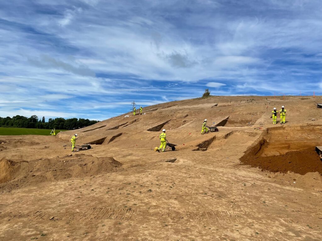
‘The first phase of building the Iron Age settlement at Broxy Kennels consisted of digging two massive ditches and constructing earthen ramparts from the upcast soil,’ said Kenny Green. ‘Radiocarbon dates reveal that this happened around 550 to 400 BC. Our team discovered the charred remains of wattle panels and pieces of daub from the roundhouses that belonged to this time. These had been thrown into the ditches when the settlement had been cleared of old buildings at some point.’
Some evidence of Iron Age metal working was also recovered during the excavation. Bog ore was found on the site along with slag – the waste material left behind after smelting iron ore. A fragment of vitrified clay was also found, part of a tuyère, part of the bellows for furnaces used in smelting and metalworking. At least two layers of vitrification were noticed on the tuyère which means smelting was carried out more than once.
‘Later on, about 400 BC, the people here filled in part of one of the ditches to the north of the entranceway and constructed a souterrain into the back-filled ditch,’ added Kenny. ‘A third ditch and rampart were newly dug, which surrounded the new souterrain and a fourth, outer rampart and ditch were also created around the hillfort.’
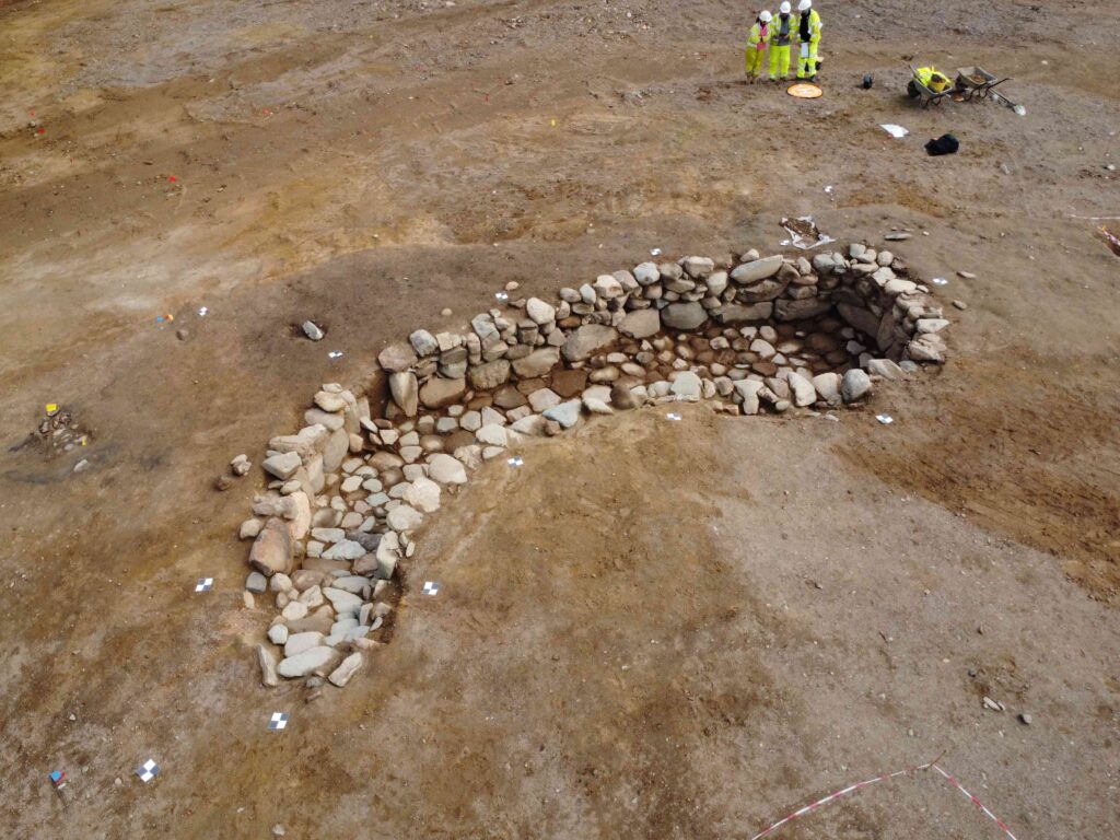
A souterrain is a semi-underground stone-built chamber and about 200 of them are known across Scotland, mostly dating to between the last few centuries BC and the first two centuries AD. These form part of the distinctive Iron Age culture of Scotland as communities across the country were open to building and using souterrains but communities to the south of the border were not, at least until Cornwall!
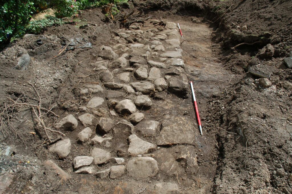
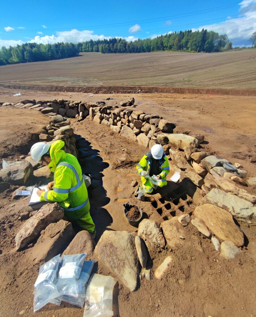
The souterrain found at Broxy Kennels Fort was 9 metres long and up to 4 metres wide and was over 1 metre deep. It was constructed from boulders probably brought up from the River Tay. The excavation revealed that it had a paved floor.
The function of the souterrain remains a mystery however despite the best efforts of the archaeologists who sampled the souterrain to a minute degree; some cereal grains were recovered from the floor deposits of the structure, but not in enough quantity to suggest it was used for grain storage. Chemical analysis of the floor deposits was also inconclusive.
By around 300 BC, the ditches and souterrain had become silted up with the loose soil of the decaying ramparts. But the hilltop settlement had not been abandoned; radiocarbon dates from pits and postholes in the interior of the fort showed that people continued to live here until the late first century AD, just before the Roman army arrived in this part of Scotland. For most of its duration then, this was not actually fortified but rather an unenclosed hilltop settlement.
‘Some of the archaeological features found in the fort’s interior may be the remains of roundhouses,’ said Kenny. ‘Centuries of ploughing, however, had eroded the top of the hill away, leaving only a few of the very deepest parts of postholes making it difficult to determine the full size and shape of any structures that may have once stood there.’
It is not clear why this Iron Age settlement was abandoned. Possibly the structure of society changed and the people moved away from this kind of settlement. Or the coming of the Roman army in the late first century AD drove the people away.
Whatever the reason, over the following two millennia, the site here was lost to the plough.
The publication of this information ensures that the Iron Age community who once inhabited Broxy Kennels Fort are not forgotten. Even though the site has been all but entirely dug away, the picture of life in Perthshire more than two thousand years ago is now better understood.
During the dig, GUARD Archaeology hosted 3 school visits, 2 university visits and several Open Days attended by over 400 visitors, and trained 10 students from the University of the Highland and Islands.
The archaeological work was funded by Perth and Kinross Council and managed by BAM Nuttall Ltd. It was required as a condition of planning consent by Perth and Kinross Council who are advised on archaeological matters by the Perth and Kinross Heritage Trust.
ARO63: Broxy Kennels Fort, Souterrain and Surrounding Landscape, Perth by Kenneth Green, John-James Atkinson, Christina Mollie Dogherty, Charlotte Hunter, Maureen Kilpatrick and Alun Woodward is freely available to download from Archaeology Reports Online.
And look out for a short booklet, Broxy Kennels HillFort by Kenny Green.
Some of the most interesting finds from GUARD Archaeology’s 2020 excavations at Constitution Street in Leith (which were undertaken in advance of the Edinburgh Tram construction) are the coins. Not only do they provide a rough date but also shed light on individual histories and economic life.
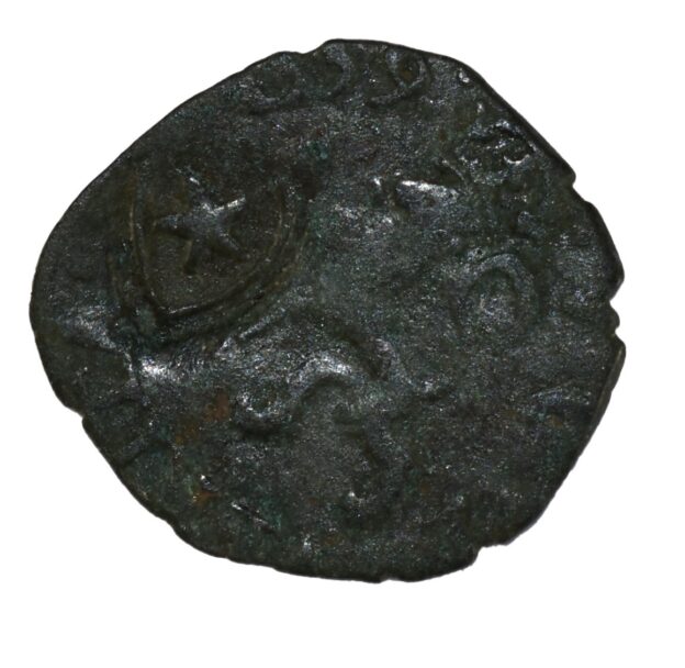
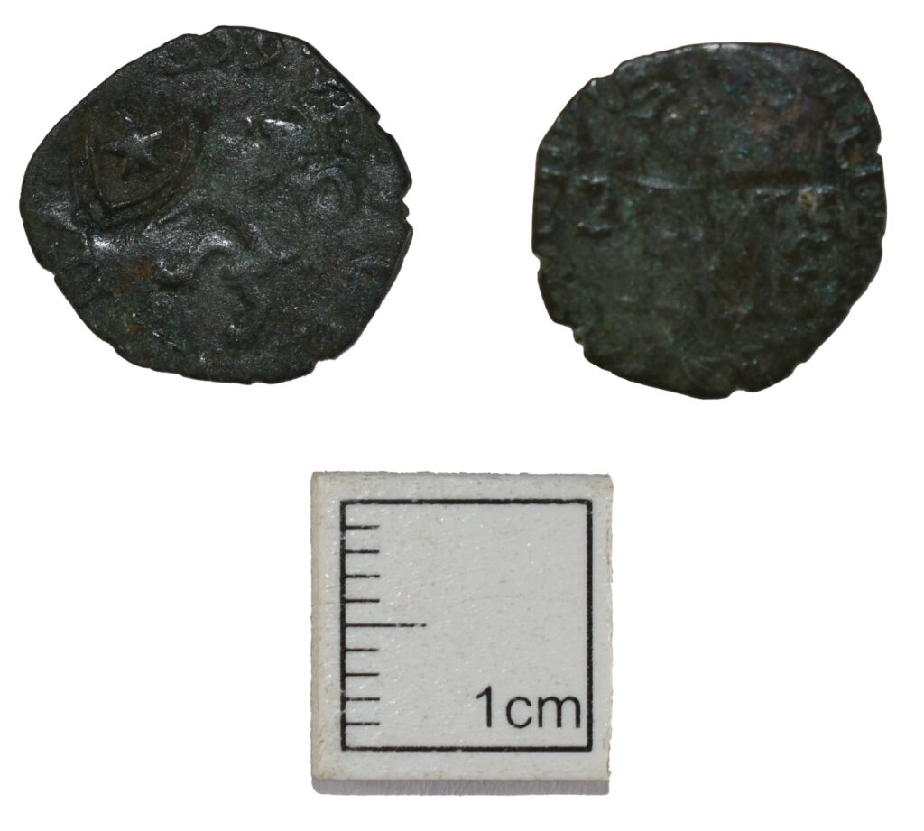
For instance, this silver two-pence coin, a billon lion or hardhead of Mary Queen of Scots and Francis II of France from 1559. In 1575 counter marking was done to combat the high number of forgeries in circulation, this coin has been marked with a heart and star. Can you spot the dolphins either side of the FM monogram?
Did you know that Mary Queen of Scots was betrothed to Francis in 1548 when she was 6 years old and he was 4 years old? And that Mary Queen of Scots on her return from France as a young widow first landed in the port of Leith on 19 August 1561?
Most of the coins found during our excavations in Leith were of low value billon and copper coins and were used as small change alongside the Scottish copper issues.
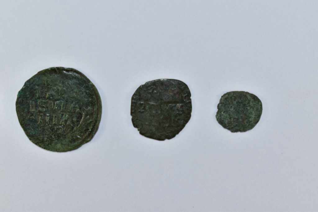
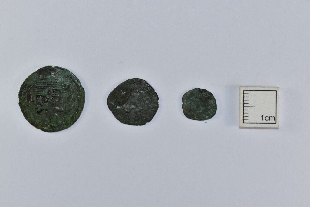
Dutch duit, Mary Queen of Scot and James III ’ecclesiastical’ farthing coins from left to right
Other coins found on site include this hammered copper-alloy ‘ecclesiastical’ farthing from the reign of James III, dating to the 1470s to early 1480s. These copper coins were extremely unpopular in Scotland with numerous complaints recorded in burgh records and parliamentary petitions. However, large numbers of these coins were exported to the Low Countries where they circulated widely.
Other side of the Dutch duit, Mary Queen of Scot and James III ’ecclesiastical’ farthing coins from left to right
A Dutch duit from the province of Overijssel was also found during excavation. This hammered copper-alloy coin dates to 1628 and has been commonly found in urban assemblages across Scotland, showing the strong trade links between Scotland and the Dutch province.