Is there anything scarier than tiny creepy worm-like creatures growing inside your body unbeknownst to you? For this Hallowe’en we will be discussing parasites…
Parasite infection was common in the population of medieval Leith as was the case in other European medieval cities, as the largest archaeological study so far of its kind on medieval populations in Scotland reveals.
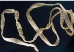
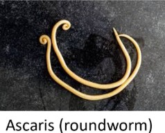
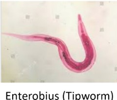
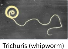
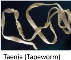
Remains of parasite eggs were found within soil samples taken from around the belly area of skeletal remains during GUARD Archaeology’s excavation of graves beneath Constitution Street in this part of Edinburgh. This was once part of the medieval graveyard of South Leith Parish Church. Nearly half of the 185 analysed skeletons were affected by at least one of four different types of parasites – Ascaris, Trichuris, Enterobius and Taenia.
While these names may not be familiar, some of them have been living with (or in!) us for a long time. Traces of Trichuris (whipworm) were reported from Ötzi, the frozen mummy of a man found in the Alps and who had lived during the Copper Age sometime between 3350 and 3105 BC.
The presence of Taenia parasite eggs indicate that the medieval Leith population, including adults and children, were eating undercooked/raw pork or beef. The presence of Taenia (tapeworm) in children was unusual and indicates not only that they were eating the same food as the adults but also that the animal feed was contaminated by this parasite too. It is possible that human faecal material was used as fertiliser for food later fed to livestock.
The rest of the parasites, Ascaris (roundworm), Trichuris (whipworm) and Enterobius (tipworm) are all soil transmitting helminth (worms), which essentially means that infection was via a direct faecal-oral route. Lovely.
This evidence demonstrates the poor sanitation and hygiene of the time.
And the importance of cleaning your hands after going to the loo!!
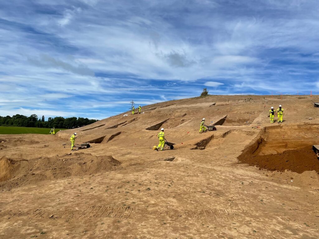
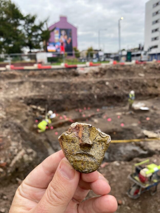
GUARD Archaeologists’ excavation of a hilltop settlement near Perth revealed a lost settlement that thrived during the Iron Age only to mysteriously fade away before the coming of the Romans, new publications reveal.
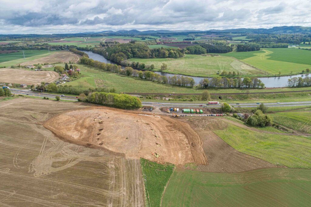
The excavation was undertaken by GUARD Archaeology in 2022 as part of the £118m Cross Tay Link Road project that involved the construction of a new 3-span bridge over the River Tay and six kilometres of new road by BAM Nuttall Ltd. Since the excavation was completed, GUARD Archaeologists have led a team of specialists drawn from across Scotland including National Museums Scotland, the universities of Glasgow and Stirling, various independent specialists and GUARD Archaeology itself, to analyse the archaeological evidence and reveal new insights into Iron Age Scotland.
‘Perth and Kinross Council are delighted that these archaeological discoveries, as a result of our construction of the Cross Tay Link Road, have led to a significant advancement in the understanding of an Iron Age community that once lived here,’ said Jillian Ferguson, Roads Infrastructure Manager at Perth and Kinross Council. ‘Many drivers and passengers travelling the new road may not imagine that they cross the site of a prehistoric fort. The construction of the Cross Tay Link Road at this site has provided an inadvertent but invaluable opportunity to learn more about how people near Perth lived more than two thousand years ago.’
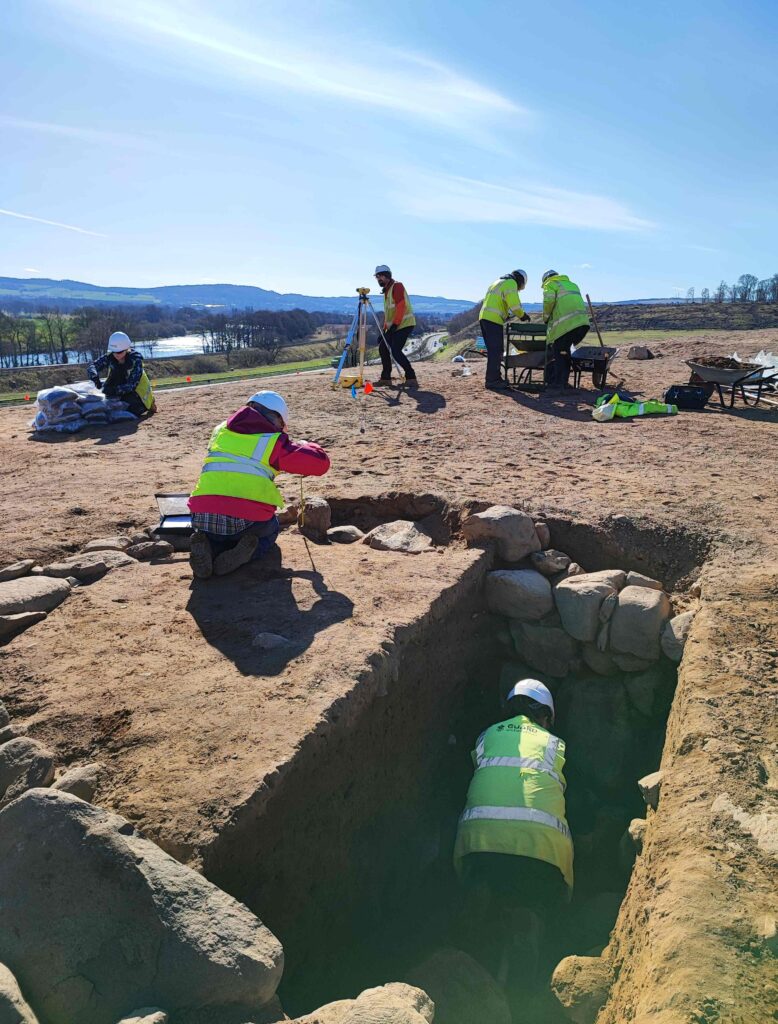
‘The hillfort at Broxy Kennels was first identified in the 1960s on aerial photographs taken along the proposed route of the then-new A9 road,’ said GUARD Project Officer Kenny Green, who directed the excavation. ‘Without these aerial photographs no-one would have known there was a hillfort here as there was no trace of it on the ground. Centuries of ploughing had removed any surface trace.’
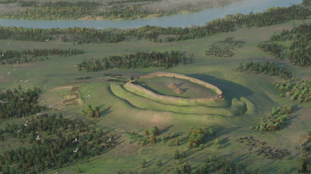
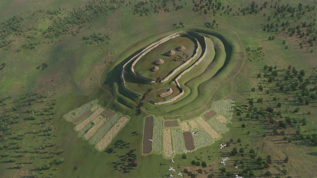
The excavation team discovered that it was during the Iron Age when people decided to settle permanently on the hill here. Many Iron Age hillforts can be found across Britain, with almost 1500 in Scotland alone. But these were not all occupied at the same time and these were not military forts. Instead, these were fortified hilltop settlements. The location of Broxy Kennels may have been chosen as a prominent feature in the landscape at a major bend in the River Tay, visible to anyone travelling from the north or south.
‘The first phase of building the Iron Age settlement at Broxy Kennels consisted of digging two massive ditches and constructing earthen ramparts from the upcast soil,’ said Kenny Green. ‘Radiocarbon dates reveal that this happened around 550 to 400 BC. Our team discovered the charred remains of wattle panels and pieces of daub from the roundhouses that belonged to this time. These had been thrown into the ditches when the settlement had been cleared of old buildings at some point.’
Some evidence of Iron Age metal working was also recovered during the excavation. Bog ore was found on the site along with slag – the waste material left behind after smelting iron ore. A fragment of vitrified clay was also found, part of a tuyère, part of the bellows for furnaces used in smelting and metalworking. At least two layers of vitrification were noticed on the tuyère which means smelting was carried out more than once.
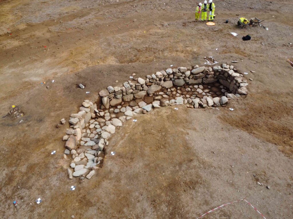
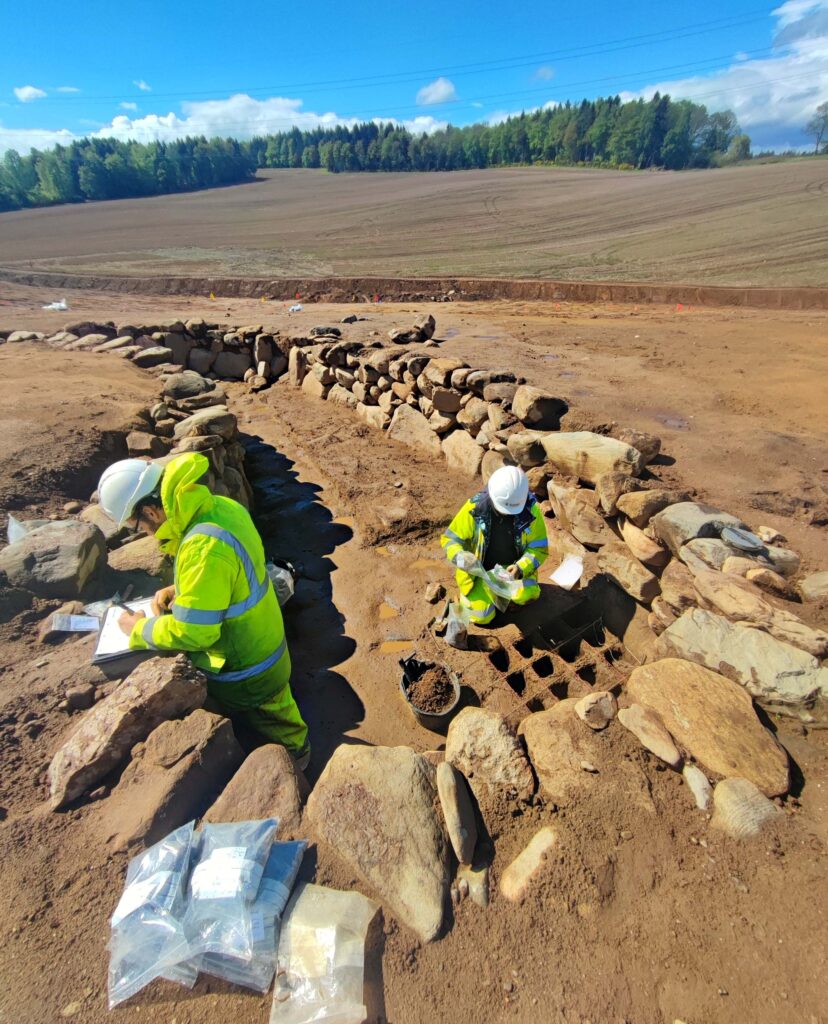
‘Later on, about 400 BC, the people here filled in part of one of the ditches to the north of the entranceway and constructed a souterrain into the back-filled ditch,’ added Kenny. ‘A third ditch and rampart were newly dug, which surrounded the new souterrain and a fourth, outer rampart and ditch were also created around the hillfort.’
A souterrain is a semi-underground stone-built chamber and about 200 of them are known across Scotland, mostly dating to between the last few centuries BC and the first two centuries AD. These form part of the distinctive Iron Age culture of Scotland as communities across the country were open to building and using souterrains but communities to the south of the border were not, at least until Cornwall!
The souterrain found at Broxy Kennels Fort was 9 metres long and up to 4 metres wide and was over 1 metre deep. It was constructed from boulders probably brought up from the River Tay. The excavation revealed that it had a paved floor.
The function of the souterrain remains a mystery however despite the best efforts of the archaeologists who sampled the souterrain to a minute degree; some cereal grains were recovered from the floor deposits of the structure, but not in enough quantity to suggest it was used for grain storage. Chemical analysis of the floor deposits was also inconclusive.
By around 300 BC, the ditches and souterrain had become silted up with the loose soil of the decaying ramparts. But the hilltop settlement had not been abandoned; radiocarbon dates from pits and postholes in the interior of the fort showed that people continued to live here until the late first century AD, just before the Roman army arrived in this part of Scotland. For most of its duration then, this was not actually fortified but rather an unenclosed hilltop settlement.
‘Some of the archaeological features found in the fort’s interior may be the remains of roundhouses,’ said Kenny. ‘Centuries of ploughing, however, had eroded the top of the hill away, leaving only a few of the very deepest parts of postholes making it difficult to determine the full size and shape of any structures that may have once stood there.’
It is not clear why this Iron Age settlement was abandoned. Possibly the structure of society changed and the people moved away from this kind of settlement. Or the coming of the Roman army in the late first century AD drove the people away.
Whatever the reason, over the following two millennia, the site here was lost to the plough.
The publication of this information ensures that the Iron Age community who once inhabited Broxy Kennels Fort are not forgotten. Even though the site has been all but entirely dug away, the picture of life in Perthshire more than two thousand years ago is now better understood.
During the dig, GUARD Archaeology hosted 3 school visits, 2 university visits and several Open Days attended by over 400 visitors, and trained 10 students from the University of the Highland and Islands.
The archaeological work was funded by Perth and Kinross Council and managed by BAM Nuttall Ltd. It was required as a condition of planning consent by Perth and Kinross Council who are advised on archaeological matters by the Perth and Kinross Heritage Trust.
ARO63: Broxy Kennels Fort, Souterrain and Surrounding Landscape, Perth by Kenneth Green, John-James Atkinson, Christina Mollie Dogherty, Charlotte Hunter, Maureen Kilpatrick and Alun Woodward is freely available to download from Archaeology Reports Online.
And look out for a short booklet, Broxy Kennels HillFort by Kenny Green.
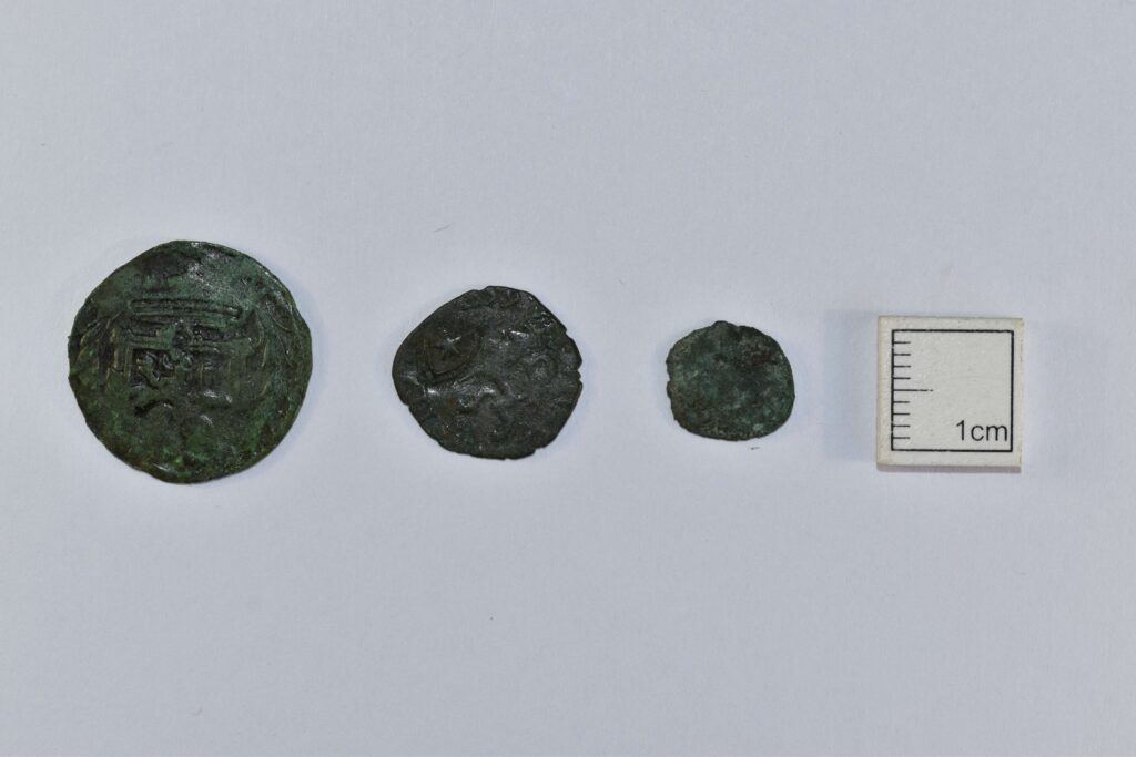
Some of the most interesting finds from GUARD Archaeology’s 2020 excavations at Constitution Street in Leith (which were undertaken in advance of the Edinburgh Tram construction) are the coins. Not only do they provide a rough date but also shed light on individual histories and economic life.
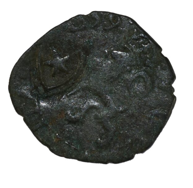
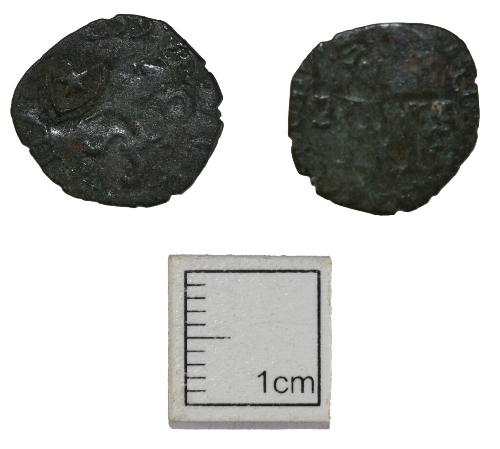
For instance, this silver two-pence coin, a billon lion or hardhead of Mary Queen of Scots and Francis II of France from 1559. In 1575 counter marking was done to combat the high number of forgeries in circulation, this coin has been marked with a heart and star. Can you spot the dolphins either side of the FM monogram?
Did you know that Mary Queen of Scots was betrothed to Francis in 1548 when she was 6 years old and he was 4 years old? And that Mary Queen of Scots on her return from France as a young widow first landed in the port of Leith on 19 August 1561?
Most of the coins found during our excavations in Leith were of low value billon and copper coins and were used as small change alongside the Scottish copper issues.
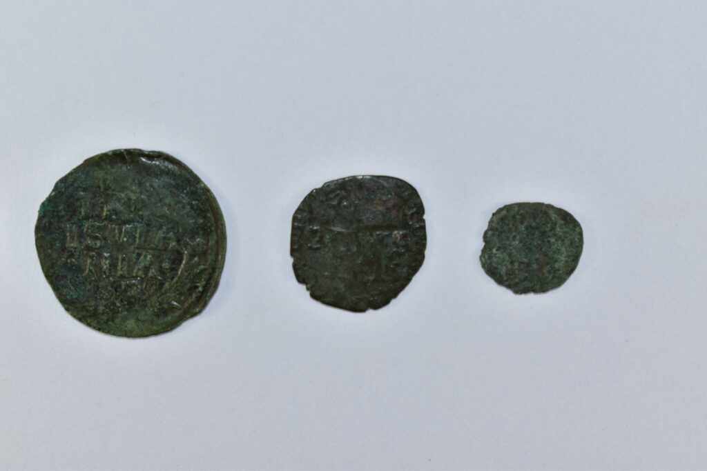
Dutch duit, Mary Queen of Scot and James III ’ecclesiastical’ farthing coins from left to right
Other coins found on site include this hammered copper-alloy ‘ecclesiastical’ farthing from the reign of James III, dating to the 1470s to early 1480s. These copper coins were extremely unpopular in Scotland with numerous complaints recorded in burgh records and parliamentary petitions. However, large numbers of these coins were exported to the Low Countries where they circulated widely.
Other side of the Dutch duit, Mary Queen of Scot and James III ’ecclesiastical’ farthing coins from left to right
A Dutch duit from the province of Overijssel was also found during excavation. This hammered copper-alloy coin dates to 1628 and has been commonly found in urban assemblages across Scotland, showing the strong trade links between Scotland and the Dutch province.
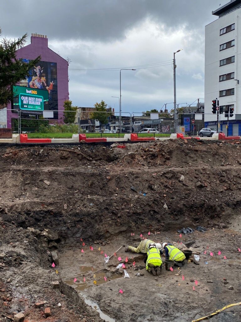
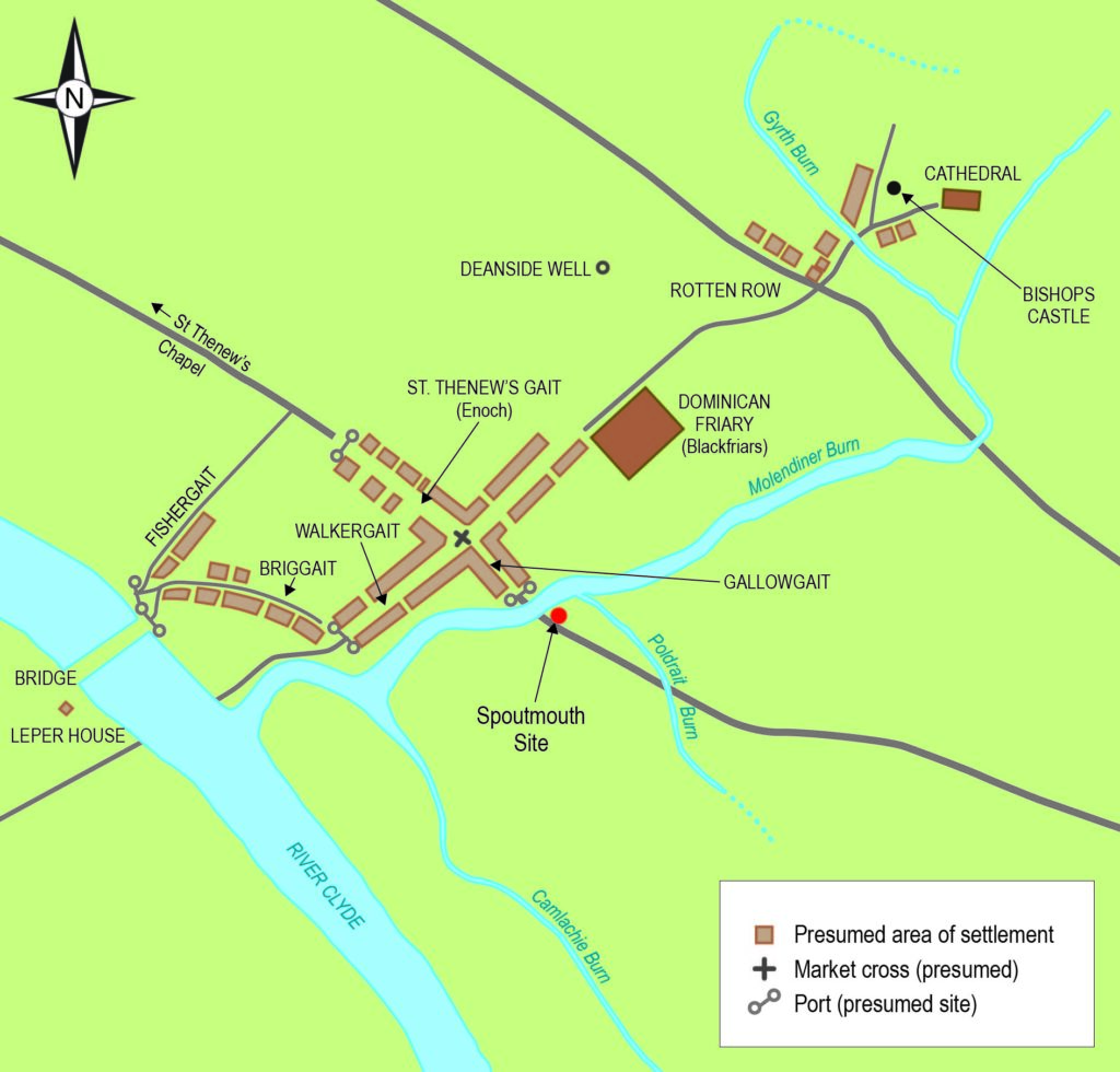
Archaeological remains of Glasgow’s earliest suburbs have been discovered by GUARD Archaeology. Several lines of well-preserved wooden posts with woven fencing, as well as pottery at a site in the Gallowgate area.
The discovery was made 4.5 metres below the current street level at the Spoutmouth area, which is being developed into social housing.
This is a remarkable survival of organic archaeology in an area of the city that has witnessed substantial development over the many years since Glasgow was first established. A small sliver of medieval Glasgow that has somehow survived centuries of building and rebuilding.
The site lay dormant as a car park until Wheatley Group developed plans to build 34 homes for social rent and two commercial units. The £9.295 million development is supported by a Scottish Government Grant of £5.57 million. As part of the planning conditions, a comprehensive archaeological investigation was required due to the site’s location on the edge of medieval Glasgow.
Aside from the foundations of 18th and 19th century buildings, nothing of great significance was apparent during the initial investigations, until the tops of wooden posts were spotted piercing through clays 4.5m down.
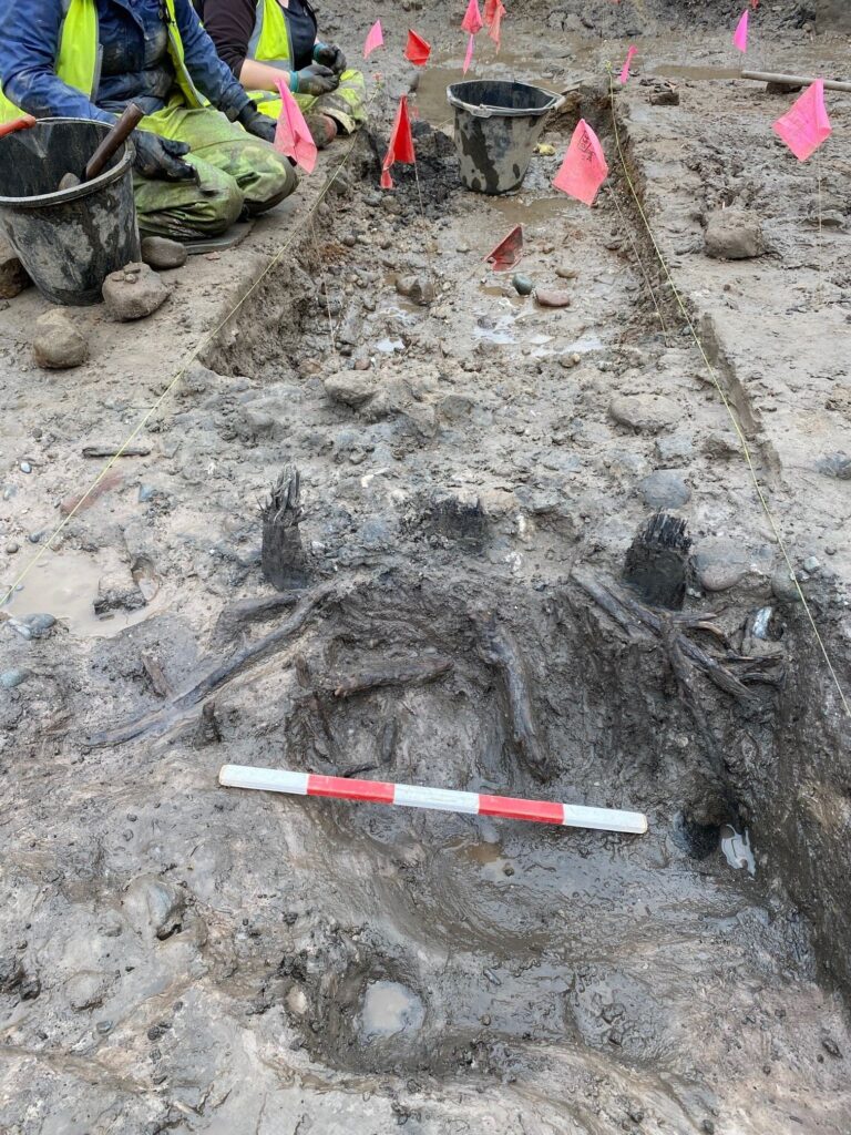
The Spoutmouth site lies on the south side of the former line of the Molendinar Burn which was once one of the most well-known water courses in Glasgow that drains into the River Clyde; it now flows underground having been culverted in the 1800s.
But going back in time, it has associations with St Mungo who founded his church on its banks in the late 6th century AD. By the 12th century the newly established bishopric and its cathedral were built not far from here at the top of the High Street. In AD 1175, King William the Lion conveyed Glasgow with burgh status. Burghs had been introduced by William’s grandfather David I and allowed Glasgow economic and legal privileges in return for significant tax contributions to the Royal Exchequers of Scotland.
The GUARD Archaeology team unearthed 63 upright posts arranged in three lines defining three broad linear areas. As these are so deep, the site is constant flooding from water but this is also why these wooden remains have survived for so long. Caught up in the wattle fencing, are numerous sherds of medieval pottery, animal bone and other organic material.
The bulk of the pottery is a mix of medieval fragments which date to around the 13th-14th centuries AD. The wattle fencing therefore appears to part of a very early eastward expansion of the medieval burgh.
This rare discovery of preserved wooden structures opens a window into Glasgow’s past when it underwent its first wave of major expansion. It is remarkable that in the same year that Glasgow will celebrate its 850th anniversary of receiving burgh status, some archaeological evidence of those beginnings have been discovered.
Further analysis of the wood and other material will be carried out in due course, following the excavation works.
Construction works will commence after the completion of the archaeological excavation. The archaeological team is expected to complete their excavation by November. Once the site is cleared, construction will commence, with completion anticipated by summer 2027.
The archaeological work was funded by Wheatley Group and was required as a condition of planning consent by Glasgow City Council who are advised on archaeological matters by the West of Scotland Archaeology Service.