Newly published research by GUARD Archaeology has revealed how a hitherto unknown Antonine Wall Roman fortlet was discovered beneath the back gardens of Bearsden.
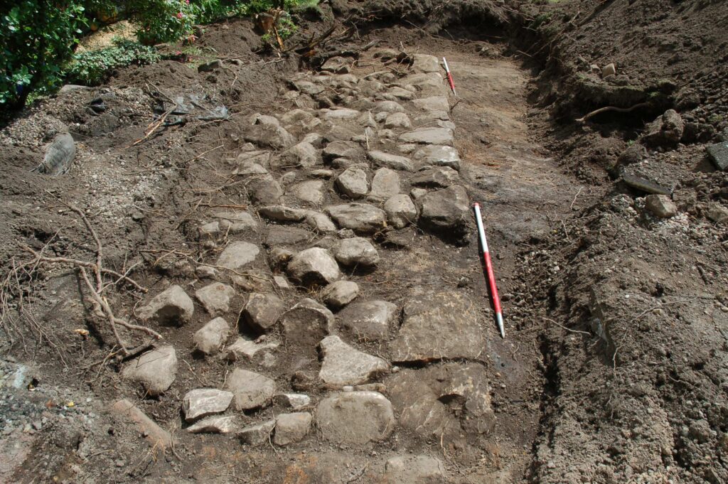
Archaeological investigations within the gardens of three adjacent residential properties in Bearsden in 2017 revealed the stone foundations of a turf rampart. The archaeological work was funded by individual landowners in advance of development and was required as conditions of planning consents by East Dunbartonshire Council.
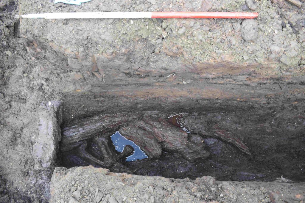
Historic Environment Scotland identified the investigations as a rare but important opportunity to discover more information about this particular area to the south of the World Heritage Site of the Antonine wall. Historic Environment Scotland subsequently commissioned further excavation which revealed a parallel ditch containing peat deposits, wood and vegetation, and also a geophysical survey which revealed stone structures, likely surviving fragments of the Antonine Wall itself.
What made these discoveries significant was that both the kerbed stone base and its parallel ditch lay perpendicular to the line of the Antonine Wall that crosses this part of Bearsden.
Wood from the bottom of the ditch was radiocarbon dated to AD 127–247 and therefore within the period of use and immediate aftermath of the Antonine Wall. Two sherds of Roman pottery were also subsequently found beneath the stone base.
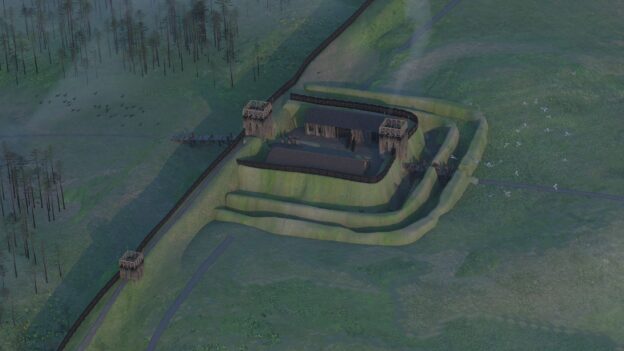
The Antonine Wall was built in the years following AD 142 by the Roman Army on the orders of their emperor Antoninus Pius (hence its name). Cutting Scotland in two, it separated the conquered Britons of the south from the free Britons to the north. Unlike Hadrian’s Wall, which was built of stone, the Antonine Wall was constructed of turf set onto a stone base. But little more than 20 years after it was built, sometime in the AD 160s, the Romans retreated back to Hadrian’s Wall.
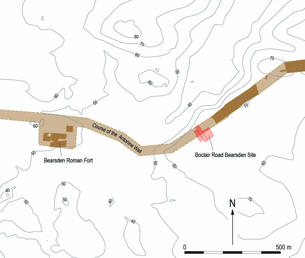
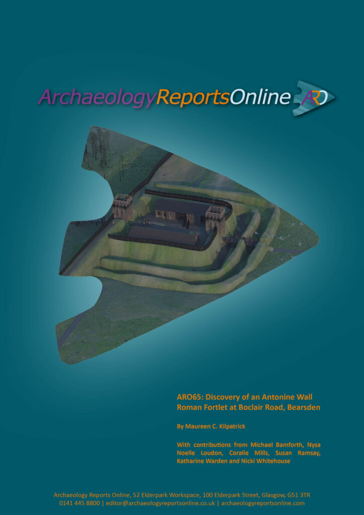
This fortlet lay on an area of high ground right next to the Antonine Wall. It had commanding views over the landscape, particularly to the north, which was beyond Roman control, and was also intervisible with the larger Roman fort at Bearsden which lay close-by to the west on lower lying ground. This suggests that the fortlet was an integral part of the Roman Wall defences which included forts along its length along with smaller fortlets like this, where small detachments from the larger forts were posted to keep an eye out.
Specialist analysis of the botanical and fossil beetle evidence from the bottom of the ditch revealed that when the fort was built, the surrounding landscape was open pasture with areas of partially cleared woodland, mainly alder, hazel and willow, with lesser amounts of oak and birch. Grasses were present within the cleared areas.
The work within the three gardens in Bearsden has revealed how important the planning process is to archaeological investigation and the discovery of new sites. Given their location and date, the archaeological remains discovered in the back gardens of Boclair Road are related to the Antonine Wall and it would therefore seem that the stone base supported a turf wall and the ditch was a section of the perimeter ditch around a hitherto unknown Roman fortlet.

ARO65: Discovery of an Antonine Wall Roman Fortlet at Boclair Road, Bearsden by Maureen Kilpatrick, with contributions by Michael Bamforth, Nysa Noelle Loudon, Coralie Mills, Susan Ramsay, Katharine Warden and Nicki Whitehouse is freely available to download from Archaeology Reports Online.