ARO30
Investigations on the outskirts of medieval Stirling discovered the foundations of the medieval Dominican friary.
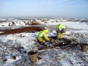
The archaeological excavation was carried out by GUARD Archaeology Ltd in 2014 in advance of re-development of land at Goosecroft Road by Cromwell Property Group (formerly Valad Europe) on behalf of the Stirling Development Agency. The foundations of substantial medieval stone walls and finely carved architectural fragments were revealed, belonging to the friary known to have occupied this area of the medieval burgh. Historical research reveals that this friary belonged to the Dominican Order – the Blackfriars – for over three hundred years, from 1233 to the Scottish Reformation in 1559.
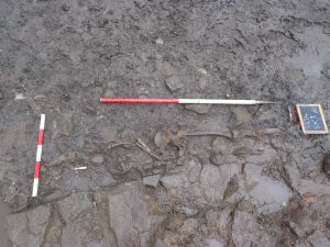
Remains of skeleton during excavation
The archaeological finds included what remained of the skeleton of a young man. ‘He had been carefully buried in accordance with medieval Christian burial rites within the precincts of the friary,’ explained Maureen Kilpatrick, who analysed the human remains. ‘He was placed on his back in an extended position and orientated east/west, with the head at the west end and the lower arms placed towards the pelvis. No skeletal pathology was noted on the skeleton, although the remains were very fragmentary, and any trace of disease may have been lost.’
The burial is consistent with other known medieval burials with regards to burial orientation and the positioning of the lower arms towards the pelvis, such as those found at other friary sites in Scotland at Aberdeen, Linlithgow and Perth. The arms placed across the body, whether across the chest or pelvis, have been interpreted as evidence of a body being firmly wrapped in a shroud and with the absence of any evidence for a coffin is more than likely the mode of burial of this individual. The location of the burial within the foundation trench of a wall is more unusual, although a similar burial of a young adult male buried within the south foundation wall of the nave was also discovered at the Carmelite friary in Linlithgow.
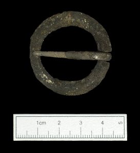
Bronze belt buckle found during excavation
While excavations at other medieval friary sites in Scotland have revealed burials of men, women and children suggesting the local populace was interred in friary grounds, the archaeological evidence suggests that this young man was a friar himself, which is usually quite difficult to demonstrate. However, as friars were buried in their habits, buckles found near the pelvis indicate those individuals being friars of orders such as the Dominicans, as their rule required them to wear a belt with a buckle, rather than a rope cincture worn by other orders such as the Franciscans (the Greyfriars). The finding of a 13th/14th century bronze belt buckle in front of the pelvic area of this individual and traces of mineralised textile on the inner edge indicating it was fastened against clothes therefore suggests that he was a friar rather than simply a local individual. Furthermore, his skeleton was radiocarbon dated to AD 1271 – 1320 so it is possible that this friar was a witness to some of the most significant events of the Scottish Wars of Independence during late 13th and early 14th centuries, not least the battles of Stirling Bridge and Bannockburn.
‘The approximately 326-year existence of the friary gleaned from historical records is now corroborated by the new archaeological evidence,’ said Bob Will who led the excavation. ‘Pottery sherds dating to this period derive from cooking vessels and jugs from different British regions as well as Continental Europe. The Blackfriars of Stirling had access to luxury table goods from around the North Sea, foodstuffs such as figs and raisins and wine. The friary as well as the burgh of Stirling was well positioned to receive imports, which may have been brought to land at Cambuskenneth Abbey which lies on the River Forth and was then navigable from the sea.’
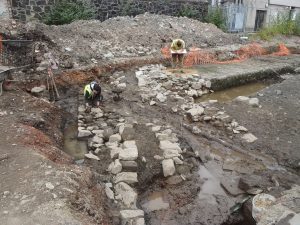
GUARD Archaeologists excavating the medieval friary
One of the walls discovered during the excavation was likely to be a boundary wall for the friary that was replaced or reinforced by another with a drain, the latter possibly related to a lavatorium or kitchen. Two window glass shards and two window tracery fragments hint at the possibilities of a leaded glass window in an ecclesiastical building dating to the late fourteenth century. However, due to subsequent development of this area of Stirling, not least the robbing of stone from the friary after its dissolution, only part of the layout of the friary is known.
The full results of this research, which was funded by the Stirling Development Agency, ARO30: Uncovering the history and archaeology of the house of the Blackfriars, at Goosecroft Road, Stirling by Bob Will is freely available to download from the ARO website – Archaeology Reports Online.
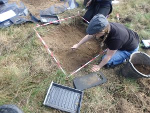
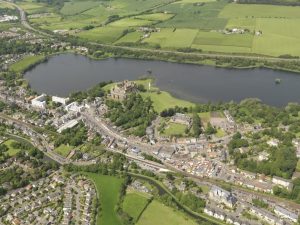

 Archaeological investigations coupled with historical research of Newcraighall on the south-east edge of Edinburgh reveal a complex story of land use changes from prehistory to the present day.
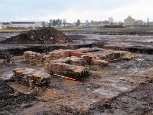 These included various sized coal pits or shafts, and the foundations of four colliery buildings, arranged around a now infilled mineshaft on the southern site. Elements of a designed landscape associated with Brunstane House included a ha-ha that traversed the northern site. The presence of several large culverts may also have connections with both landscape alterations and the coal-mining industry. Fragments of curved and linear ditches appear to be remnants of earlier field systems dating from the medieval and post-medieval periods and associated with extensive remnants of broad rig cultivation found across the two areas.
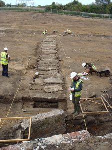 The historical research demonstrates the complexities of landownership with evidence of the development of coal mining and coal ownership and the social and economic realities of the times. Examination of papers relating to Brunstane House showed that they had direct bearing on the understanding and dating of the landscaping features and other groundworks, including changes to the estate boundaries and the runrig system. A labourer’s diary from the winter of 1735-6 was an especially interesting find from the point of view of what work was undertaken on the estate, by whom and for how much.
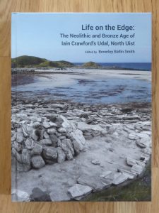 Newly published archaeological research from excavations undertaken at the Udal in North Uist reveals some of the hardships of life in Neolithic and early Bronze Age Scotland. Two burial cairns held the remains of individuals dating to the second millennium BC. Scientific analyses of these individuals demonstrate the dramatic effect that environmental stresses had on the community.
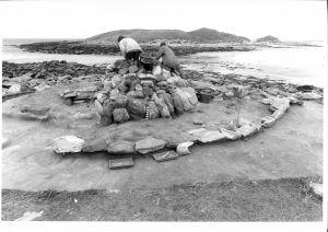 The accumulation of sand and the flooding episode separated the end of the late Neolithic settlement from the beginning of the early Bronze Age, around 2400 BC. Sometime after the creation of the beach, a burial cairn was built, under which a young man was laid to rest in stone cist. This large round mound of stone and turf was the largest man-made structure on the Udal peninsula. By erecting the cairn, the inhabitants that lived in the area claimed back the landscape as theirs. The monument was meant to be enduring and it lasted approximately 4000 years before coastal erosion threatened it, necessitating its excavation.
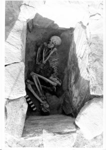 ‘Our Neolithic and Bronze Age ancestors lived through climate change events such as dramatic sea-level rise and increased storminess, and trauma such as loss of fields, crops and animals. They had to relocate their settlement and houses to safer areas,’ said Beverley. ‘How the inhabitants of the Udal survived during the Bronze Age will be part of the research on the next Udal site – the South mound.’
 Recently published research from two sites at opposite ends of Scotland reveals new evidence for Bronze and Iron Age landscapes.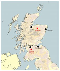
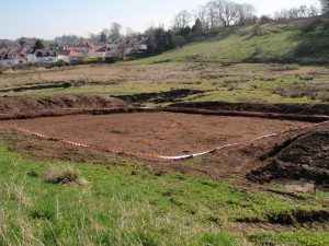
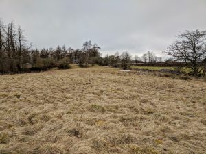
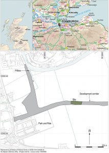 Recently published research by Bob Will of GUARD Archaeology reveals the discovery of the complex history of settlement at a place in the Lothians of Scotland, from the Neolithic through the Bronze Age and Iron Age into the early medieval period.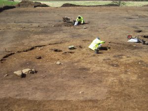
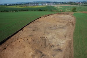 Two truncated roundhouses near the north end of the site were dated to the Iron Age. An associated fragment of a miniature quern was recovered; these tend to be found in the east of Scotland during the Iron Age. The final phase of activity on-site comprised the remains of two corn-drying kilns, dated to between the sixth and eighth centuries AD, that survived as oval pits containing considerable quantities of burnt and charred cereal grains. Associated with the better-preserved kiln was a rim sherd of coarse pottery and two fragments from a rough quern.
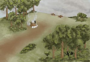 While the archaeological investigations provided evidence for occupation of this place over a long period of time, it was surprising that little evidence for settlement from the Roman occupation of southern Scotland was encountered, considering the presence nearby of a Roman fort, milestone and temporary camps. The archaeological remains from the excavation nevertheless provide a palimpsest of prehistoric and early medieval occupation and support similar occupation and settlement evidence from the wider region. The early medieval date for the corn-drying kilns provides direct evidence for settlement and agriculture, as well as a domestic setting for the long-cist cemetery at Catstane to the north. Together with another nearby long-cist cemetery to the south and contemporary field boundaries near Gogar Church, the results are combining to gradually fill out a picture of sustained settlement and agriculture in this area of the Lothians during the early medieval period.
 Recently published research reveals a range of artefacts recovered from two sites on the edge of the medieval burgh and castle at Stirling.
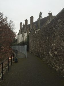 This section of footpath runs behind Cowane’s Hospital next to the Church of the Holy Rude and on the perceived line of the Stirling town wall, which was constructed sometime in the sixteenth century.
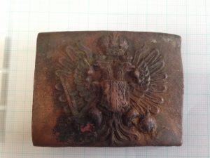 One of the more unusual artefacts to be recovered from the Back Walk was a WWI military belt buckle. The military buckle is from the Austrian army and has the double headed imperial eagle and the Austrian coat of arms and is one that was standard issue during WWI.
 The results of one of GUARD Archaeology’s community archaeology projects, undertaken with the Dumfriesshire and Galloway Natural History and Antiquarian Society has been nominated in the